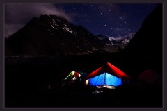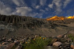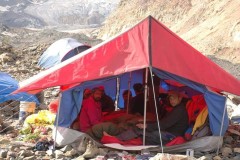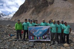
Mount Mulkila Expedition(2018)
MOUNT MULKILA EXPEDITION(6517 mt)
To
The Hon. Secretary
The Himalayan Club
314 Turf Estate , Shakti Mills Lane,
Off Dr. E. Moses Road, Mahalaxmi,
Mumbai – 400011, INDIA
Subject :– Application for JAGDISH NANAVATI AWARD ‘2018 .
Sir /Madam,
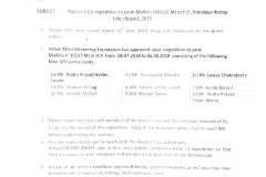
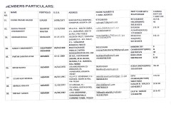
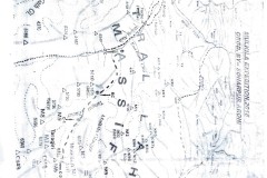
We are heartily grateful that we have been nominated for the JAGDISH NANAVATI AWARD ‘2018 . We conducted our expedition from 16th August to 13th September,2017 with 13 members including 4 Sherpa members. All the members were under insured and all are Indian by origin . According to the guideline of selection criteria all the related documents (itinerary, members details , expedition map , 15 photographs) are being sent to you through emails and a hard copy with a brief report . And we will also send a brief article for the forthcoming Himalayan Journal within 15/12/17 by e-mail.
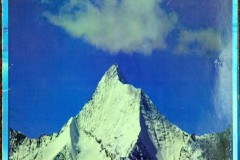
- A) Research and planning before the expedition starts:History says, a 4 membered team from Japan once tried to approach this Virgin peak (6113m,Long:76 degree 42-43 E; Lat:32 degree 34 43 N ) of Chamba district ,HP, 35 years ago. It was their stroke of bad luck that one of the members got wiped out under the waves of the river, thus marked the end of the expedition. But there is no official records about this venture. Again in 2012 a team from Sonarpur Arohi went there to explore the area along with a mission to climb our targeted peak. But lack of sufficient information and adverse weather condition forced them to abandoned their expedition. However, they managed to collect the photograph of our targeted peak and suggested possible route to reach the summit. This history of repeated failure encouraged us to explore the area and to attempt the summit.
We planned to approach the route to summit during August-September as the weather in Himachal Pradesh is known to be less hostile for the period. We planned to complete our venture from Kolkata to Kolkata 30 (thirty) days .
We were in mission to follow the route as depicted by the team from “Sonarpur Arohi” that approached the region in 2012 and we planned to undertake a through exploration of the region as we fudged towards our goal earlier.
As climbing gears we packed 1600 meters of fixed rope , two 50 meters climbing rope , 27 snow stakes , 7 tubular pitons , 25 rock pitons , 80 carabineers and 3 sherpa and a sherpa cook to assist us .
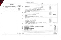
480 Kgs of rations including 4-5 days of high altitude food seemed appropriate for us for 13 heads for 30 days. The total expedition cost was Rs. 5 lakh and Twenty thousand.
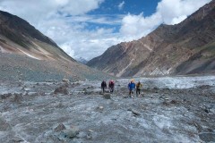
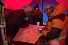
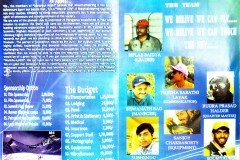
B) Execution and the conduct of the Expedition: As there was no further history of any expedition at that region we tried to gather information from our previous expeditions of that area. We also collected data from Google and contour( Sheet Number—52D/10). After a thorough research about the area we discussed about our possible course of action with the fellow members of our club .For the proper exploration cum expedition we decided to build a balanced team, and thus we selected a team of 09 members with three experienced climbers ,among whom two Everesters ,and six energetic young climbers.
So far, during our approach to our target we felt that our planning in regard to ration , time periods, helping hands, equipments and route was accurate to attempt for the peak. Though the attempt to scale the targeted peak failed , we had succeeded in exploring the region including the East face and the regions surrounding’s both ridges of our Target. Besides that we scaled a highly technical virgin peak (5789 meters,Long-76 deegri,42′ 48″ E and Lat-32 deegri,35’05” N).
C) Reporting on return: Our targeted peak has three buttresses and we had tried to climb the peak along with those buttresses and explored the entire area. Even after our repeated attempts to climb our targeted peak, we failed to reach the summit as those three buttresses were detached from the peak at some points. So we decided to abandon our targeted peak. Our time was escalating, so we decided to climb another virgin peak(5789 m), situated north ridge of our targeted peak through camp 1 and we successfully summitted it. We intimated IMF and West Bengal Mountaineering and Adventure sports Foundation (WBMASF) about our successful climb within sixty days of our return to Kolkata.
D) Sensitivity to the Environment: We brought down all the garbage from the upper camps to base camp. Then burning the bio-degradable garbage, carrying all non-biodegradable litters with us up to Manali. We reached Manali on 9th September night. 10thSeptember was Sunday. That’s why we could not deposit it to local administration. We gave charge to our hotel boy for deposition of the garbage to the local administration on 11thSeptember and we started our return journey for Chandigarh on same day early morning.
E) Welfare/Insurance measures for hired support: We had duly emphasized on our safety and security and therefore we insured every members of our team including three Sherpas and the cook in the case of some unforeseen event. We had agreement with the our agency (Manali Horses and Mule Association) regarding payment and insurance for the porters.
F) Extent of reliance on support staff for establishing high camps and opening routes: The sherpas were not much experienced but they gave us excellent support throughout the expedition. They opened the route on the first and second buttress climbing on some of the most dangerous rock face of fragile slates with thin layer of snow over there.
G) Success of expedition: There are several aspects of this expedition:
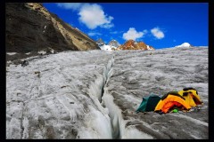
I) Technical: a) In spite of having bad weather condition and low visibility we have tried to find the route of our targeted peak and our whole team was determined to find an access to reach the Summit. Our effort was not wasted altogether. We have spied the area thoroughly from the top of the two buttresses. The actual topography of the area that we have explored is altogether different from what we see in Google Earth or Contour. The buttresses are not continuous, and they do not touch the peak wall directly and there are dangerous sheer falls in between and some are more than 800 meters in depth. Moreover, the rock face of the third buttress is very fragile and not suitable to climb.
b) We thought for a while to climb all the way down to the trunk glacier and try the ice wall beyond the third buttress but we have not that much of time in hand and of course , there was no guaranty to find a reasonable climbing route on that site. But I think that there should be another try through that side.
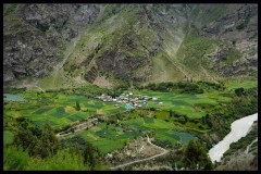
II) Exploration: a) Besides the thorough study of the area we have also tried to know about the history and culture of the area. We also came to know in details about the Alyas.When we were approaching to our Base Camp from Jholing village , we heard that our B.C. is on an “Alyas”. According to the local people Alays is a grassy base ground or camp ground on both sides of passes. It is locally known as “Lahesh”. From time immemorial the Gaddi tribes went regularly to Lahul & Spiti district during the beginning of the summer from Bharmour, Chamba district through some passes for the nutritious grass of their flock of sleep. And again they use the same route to retreat at the advent of the winter. They used only the alyases to graze their flocks. Kugti , Chhobia and Kalicho passes of Chamba area have alyases on both sides. As our B.C. was on an alyas, so it must have another alyas on the other side of the ridge and it certainly is there. So we can say obviously that from our B.C., we can reach the alyas of the opposite side near Kugati village through trunk glacier between our targeted peak( ) and the Tent peak . I think, eventually they might had discovered more easier route and they renounced this route for ever. As this route is not in use for long long time, the people are not aware about existence of such route.
b) We had tried to reach the summit of our targeted peak from different sides and explored the entire area we had seen many beautiful technical peaks which are still virgin as there is no record of any expedition at that region. In the north side of our base camp and the backside of Thirot there lies a mountain. The locals call it ‘Mt. Nilkanth’. Behind Mt. Nilkanth there is a lake, ‘Nilkanth Mahadev Lake’. One day walk from Thirot. After returning back from our expedition we studied ‘Google Earth’ thoroughly and learnt that if that lake is made base camp then it is possible to climb at least three 6000 meter peaks including Mt. Nilkanth.
We hope that our effort and experience which we had gathered at this expedition of that area should encourage mountaineers for more expeditions at that region.
With regards
Rudra Prasad Halder
(Leder of this expedition &
Secretary of Sonarpur AROHI)
